WatershedsVirginia's Watershed Systems
Virginia has 8 major river basins. They consist of: Potomac-Shenandoah, Rappahannock, York, James, Roanoke, New, Tennessee-BIG Sandy, Chowan and the Coastal Rivers.
Vocabulary for this unit: topographic maps: a map showing the surface features of an area abiotic: the nonliving factors in an enviroment, water supply, topography, land forms, soil, and or air quality ridgeline or divide: higher elevation areas that seperate the watersheds elevation: high land above sea land at any point contour lines: imagenary lines that connect points of land with the same elevations contour interval: distance in elevation between two contour lines States that flow into the Chesepeak Bay Watershed: New York Virginia Pennsylvania Maryland Washington DC West Virginia Deleware 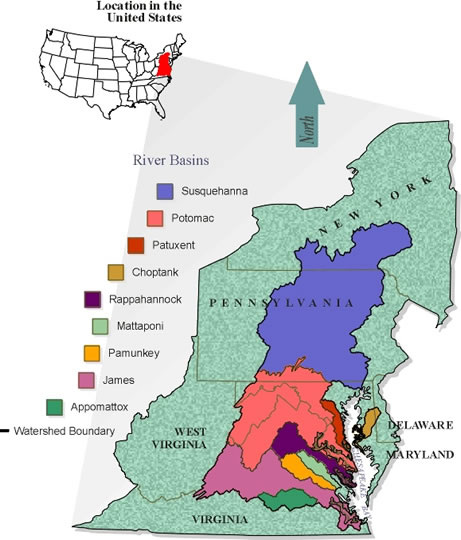
|
